

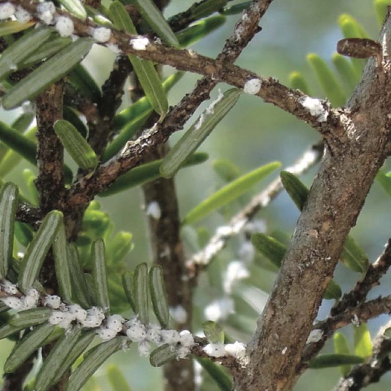
Hemlock Woolly Adelgid (Adelges tsugae Annand, HWA) is a non-native pest that causes widespread foliar damage and potentially irreversible tree mortality in eastern (Tsuga Canadensis L.Carr.) and Carolina (Tsuaga caroliniana Engelm.) hemlocks throughout eastern North America.
To understand the implications of hemlock decline in biogeochemical cycles in forest landscapes, the hemlock morbidity distribution and its recovery patterns need to be mapped over time. Recently, satellite-based change detection techniques have been widely used to improve forest infestation monitoring; however, mapping spatial and temporal trajectories of hemlock forest disturbance from pre-infestation to recovery stage remains poorly investigated.
In this study, our objective is to use multi-temporal Landsat satellite images to investigate the performance of Tasseled Cap Transformation (TCT) indices in capturing spatial and temporal trajectory of HWA-induced hemlock mortality and following sub-canopy regeneration. This study was performed over the Linville River Gorge Wilderness area in Southern Appalachian Mountains. The time series of three TCT indices—brightness, greenness, and wetness—were produced by using all available Landsat images from 1990 to 2017 (1032 images). In addition, the time series of TCT indices were estimated by a time series analyses which can separate inter-annual (low frequency) disturbance patterns from seasonal phenology (high frequency) signals. Analyzing the anomalies of predicted and observed TCT indices time series suggested that greenness and wetness time series are more accurate in determining the initial timing of both HWA infestation and regeneration process, compared to brightness. These two indices not only can detect the infestation related changes, but also the long-term recovery patterns in previously hemlock dominated forests by deciduous trees.